Overview
Location: Coyote Mountains Wilderness, south of Anza Borrego Desert State Park in Imperial County
Trail name: The Domelands Trail
Best season: November through March
Length: 8.75 miles from the trailhead
Number of nights: 1 night. Can be done as a day hike.
Route type: Loop (trail not well defined in second half)
Elevation gain: 1,365 ft
Terrain: Exposed, rocky, soft sand, steep hills, minor scrambling and squeezing through boulders.
Difficulty level: 3.5 out of 5. Intermediate, due to the exposure and navigational challenges.
Please note that all elevation gains, distances, and trail descriptions are subject to variation depending on the app, GPS, or hiker who recorded them. The details below are what I recorded and may vary slightly from others.
Why it’s a great trip
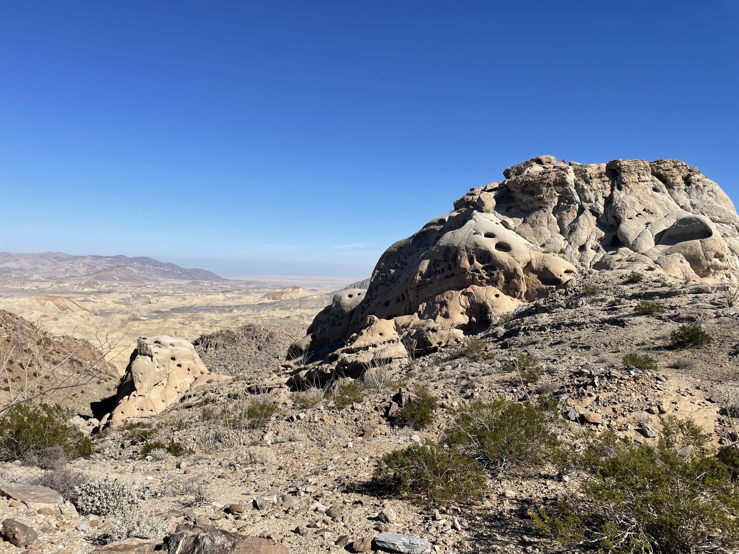
You are walking through a living museum.
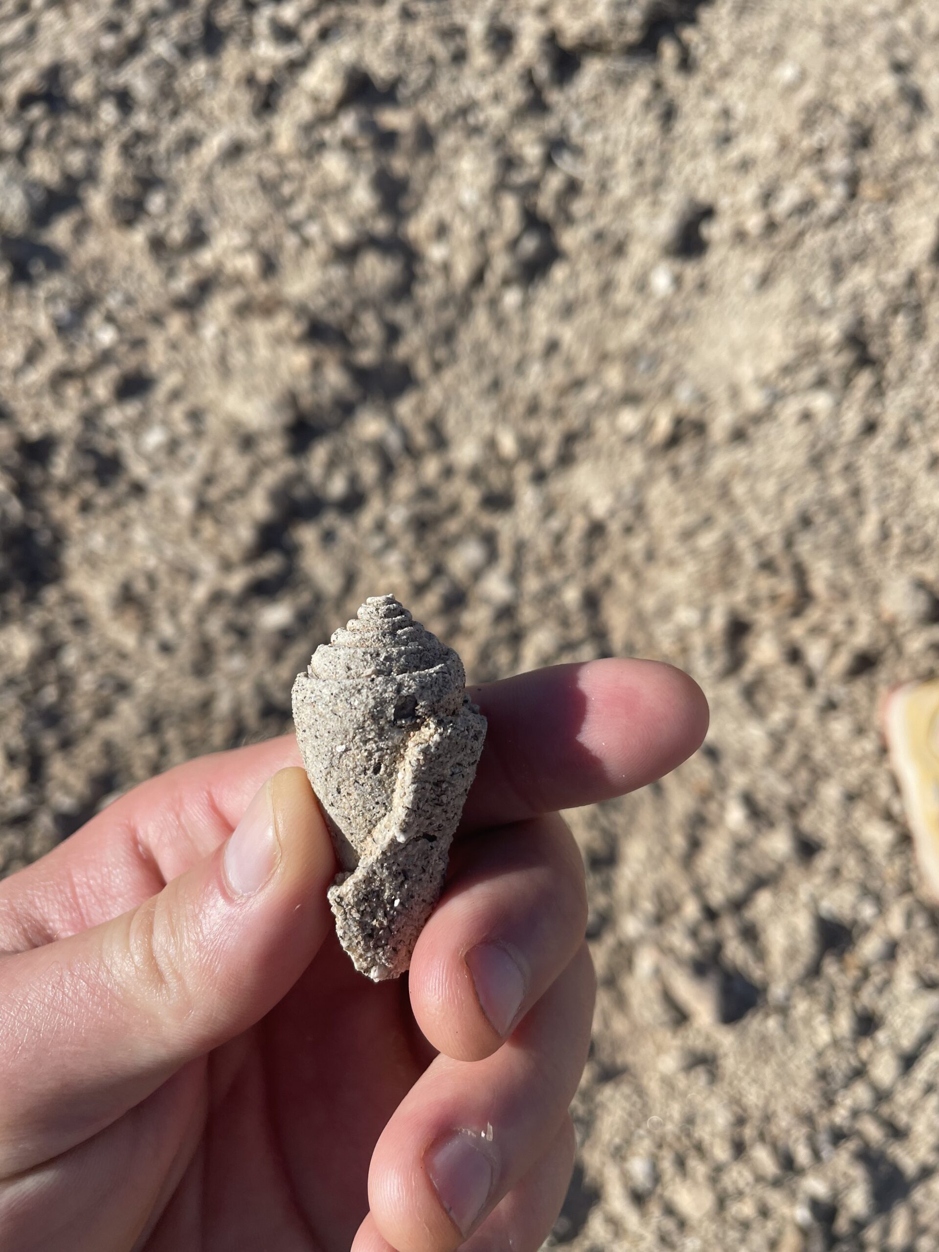
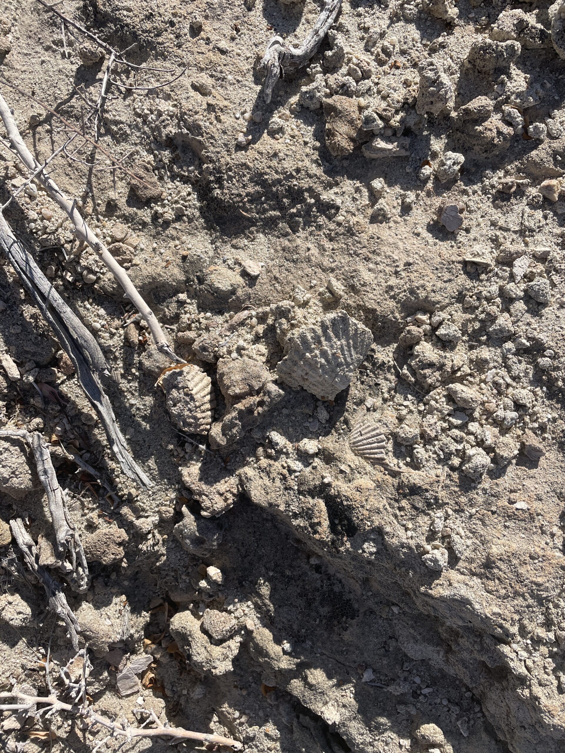
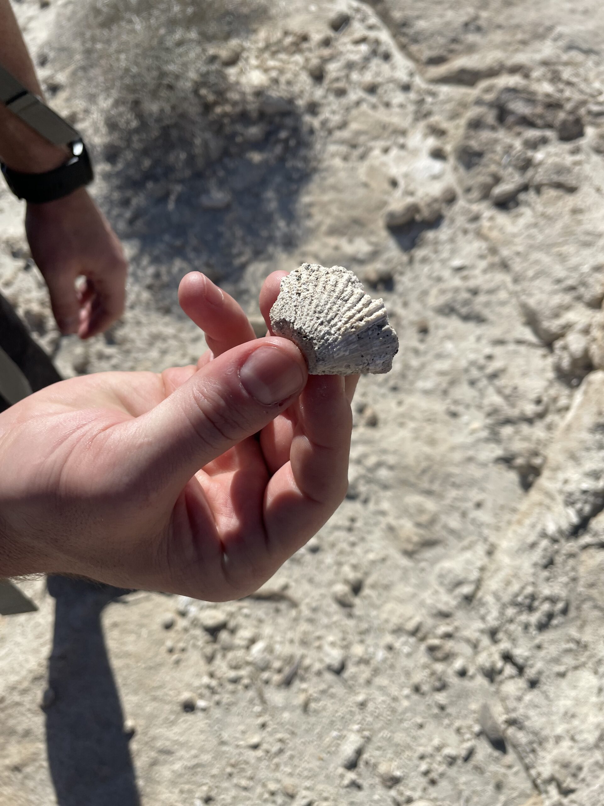
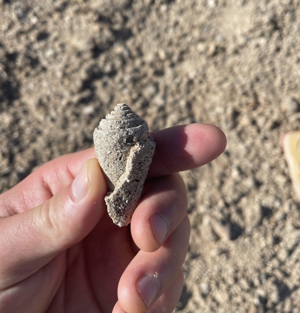
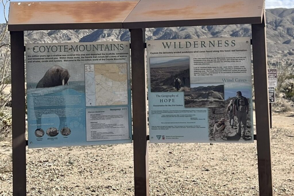
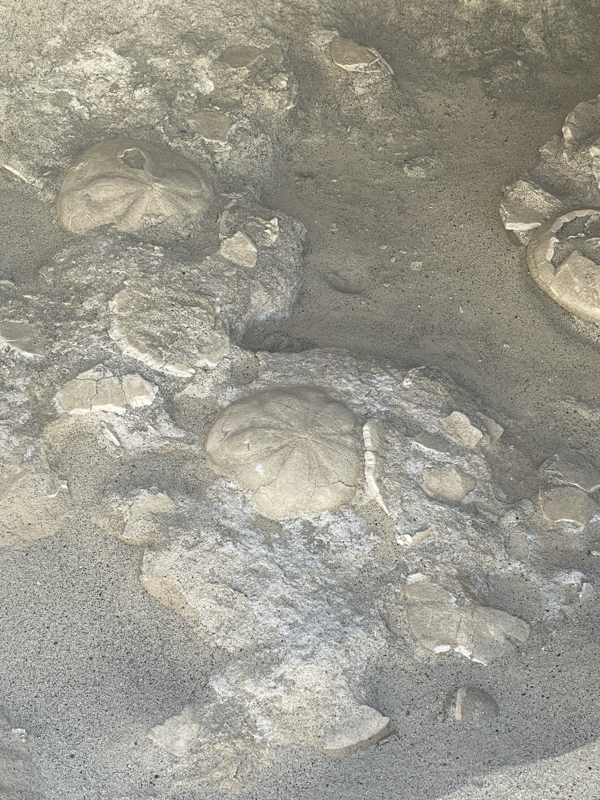
6 million years ago, this area was covered by a shallow sea that extended up as part of the Sea of Cortez in Mexico. With the lake having receded, the area is now an expansive desert filled with slot canyons, wind caves and great views of the Carrizo badlands. This trail in Southern California is also rich with fossils from whales and walruses to mollusks and other sea creatures, many of which you might see yourself. While the marine fossils are the highlight the landscape is so unique that you will be in awe no matter what.
What type of land are you on?
Current Management
Managed by the BLM (Bureau of Land Management), the Coyote Mountains is a designated Wilderness Area. To learn more about Wilderness Areas in general, see our article here.
Original inhabitants
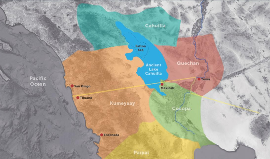
This area was originally inhabited by the Kumeyaay Nation. The Kumeyaay lived in the areas of current day northern Baja California, and areas of Southern California. Many artifacts of this tribe can be found across parks in the San Diego region, including Mission Trails Regional Park, and the Mt. Laguna area.
To learn more about them visit the Imperial Valley Desert Museum (photo of traditional territories from www.ivdesertmuseum.org).
Planning
Permits
No permits are required for hiking or backpacking in the Coyote Mountains Wilderness.
Getting there and parking
Google map for the Domelands Trail turn-off
Less than 90 minutes from San Diego by car. Take highway 8 East for roughly 82 miles, then take the exit for County Rt S2/Imperial Highway, make a left at the exit and it will take you through the town of Ocotillo. About 7 miles down on the right you will find the pull off for the Coyote Mountains Wilderness, indicated by two large signs that provide an overview of the area.
There are several parking lots at the trail head and directly before it. Please note it is a 1.5 mile bumpy dirt road and is best suited for high-clearance vehicles – I had no trouble at all with a Subaru Forester. We did see several 2WD vehicles at the trailheads, but please go at your own risk.
Nearby supplies and services
Ocotillo is the closest town, and there is a gas station at the exit you’ll take which should have any last minute items from snacks, water, sunscreen, and gas. There is the aptly named Lazy Lizard Saloon in town, and while I’ve never been just yet, it looks like a good spot for a cool beer on a hot day (let us know if you’ve been).
Otherwise, there is not much else until you go all the way through Anza Borrego, so please plan accordingly and bring plenty of water.
Recommended gear
- Water bladders – we carried 4+ liters per person, plus electrolyte tablets
- Dehydrated meal packs, salty/sugary snacks
- Single stove/propane/1 liter water pot
- Sunscreen – necessary all year
- Good sleeping bag (35 degrees winter, 50 degrees summer)
- Long-sleeve clothing and a hat to protect from the sun
- Warm clothes for nighttime
- Wag bag for pooping
Rules and regulations
This is a Wilderness Area which means foot traffic only, and no motorized items of any kind including mountain bikes, and drones. For more details on Wilderness regulations, please read here.
Because this area is a geological goldmine and holds ancient history, you are forbidden from removing any fossils or rocks from the area. Please leave the place as you found it so that others can enjoy this unique area.
No campfires allowed in the wilderness area. However, note that campfires outside of the designated Wilderness boundary are allowed, as long as their in a container (we typically use a galvanized trash can which makes clean up easy after the coals have cooled).
Always practice Leave No Trace principles.
Other important things to know
- The second half of the trail is much less identifiable, or virtually non-existent in some areas and requires keen eyesight and intuition, as well as good GPS, maps and/or navigational skills. Some cairns (stacks of rocks indicating direction or turns on a trail) can be found, but are never guaranteed and are only rough indicators of direction.
- You should use a wag bag. What is a wag bag? It’s a bag that you poop in and carry out with you. In the desert it takes a long time for poop to break down. Not too mention that the toilet paper is harmful, it’s unsightly for others, and it’s rife with harmful bacteria/viruses that can seep into water supplies.
- Be careful of flashfloods. These are extremely deadly and you should not hike into canyons or washes during a storm or rain. Please do your research and go at your own risk.
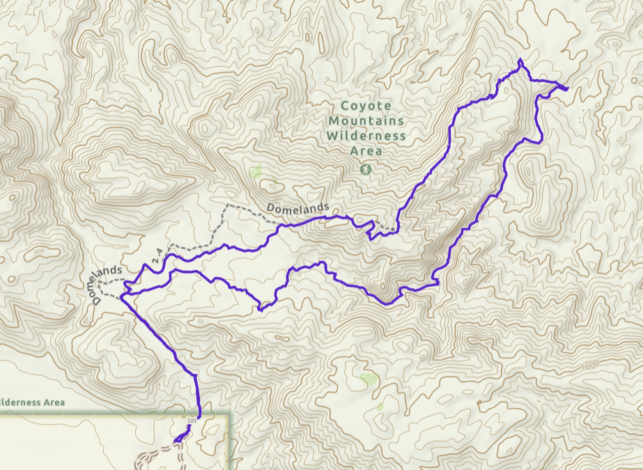
Trip Details & Navigation
The trail map was made on Gaia GPS, and has several key waypoints marked. I recommend downloading a map to your phone prior to arriving at the trailhead, and don’t forget a physical map if possible.
Route on Gaia GPS: Backpacking route – The Domelands Trail – Coyote Mountains Wilderness
IMPORTANT – We went clockwise on this trail, although it is doable both ways.
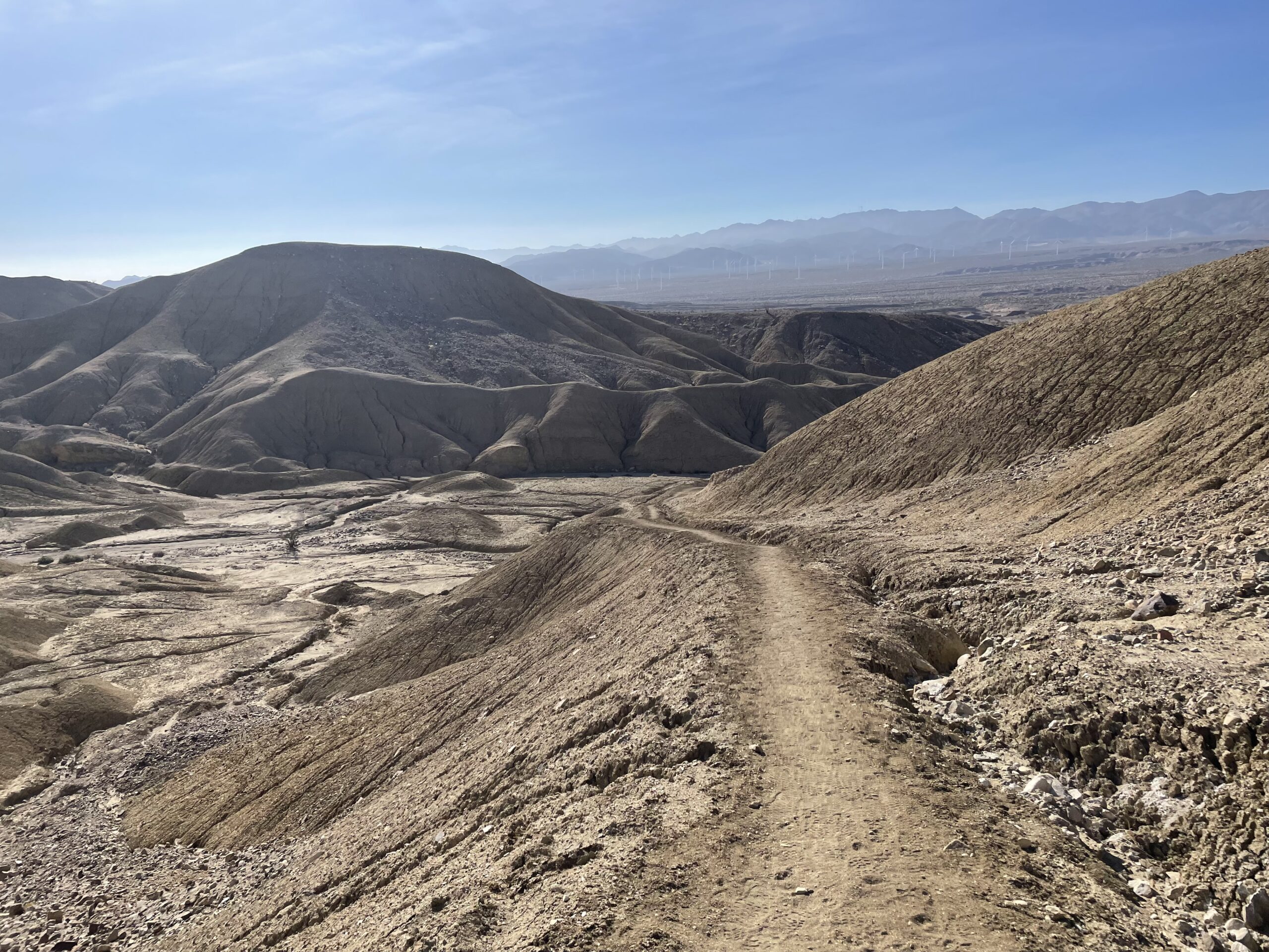
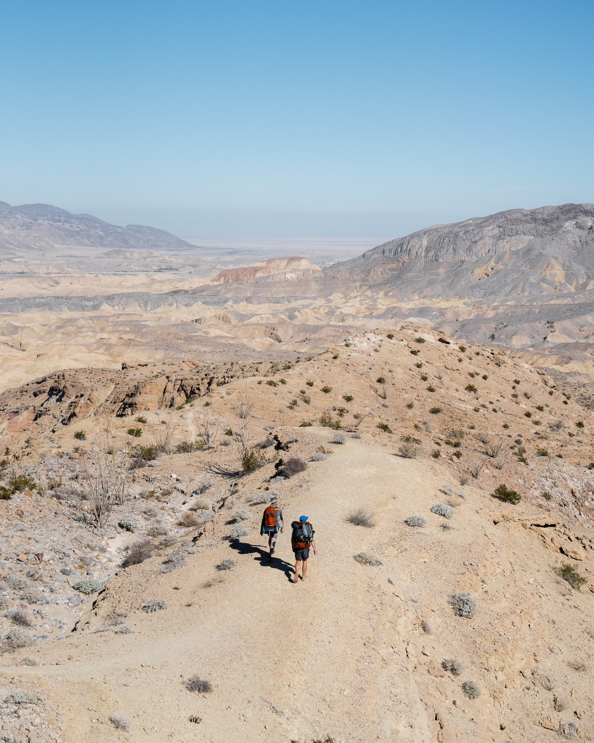
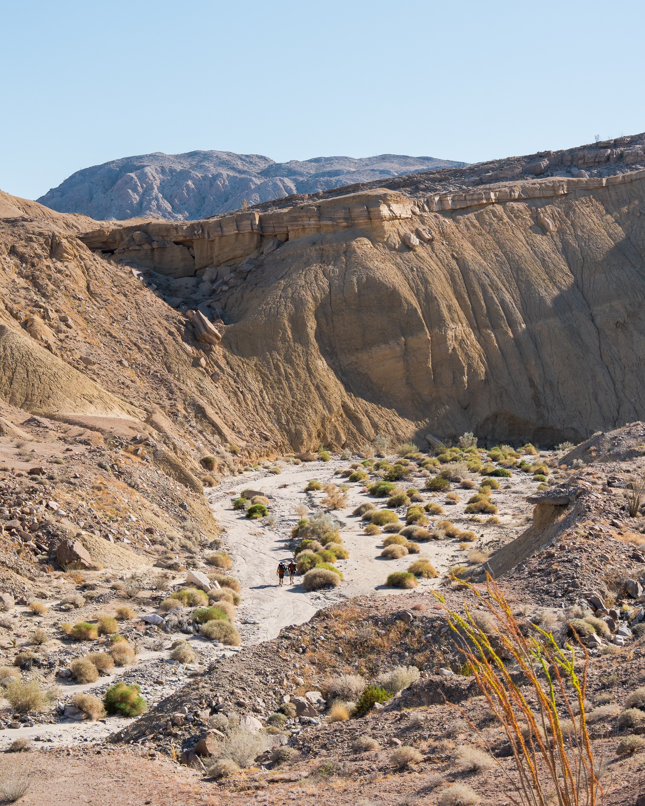
First section
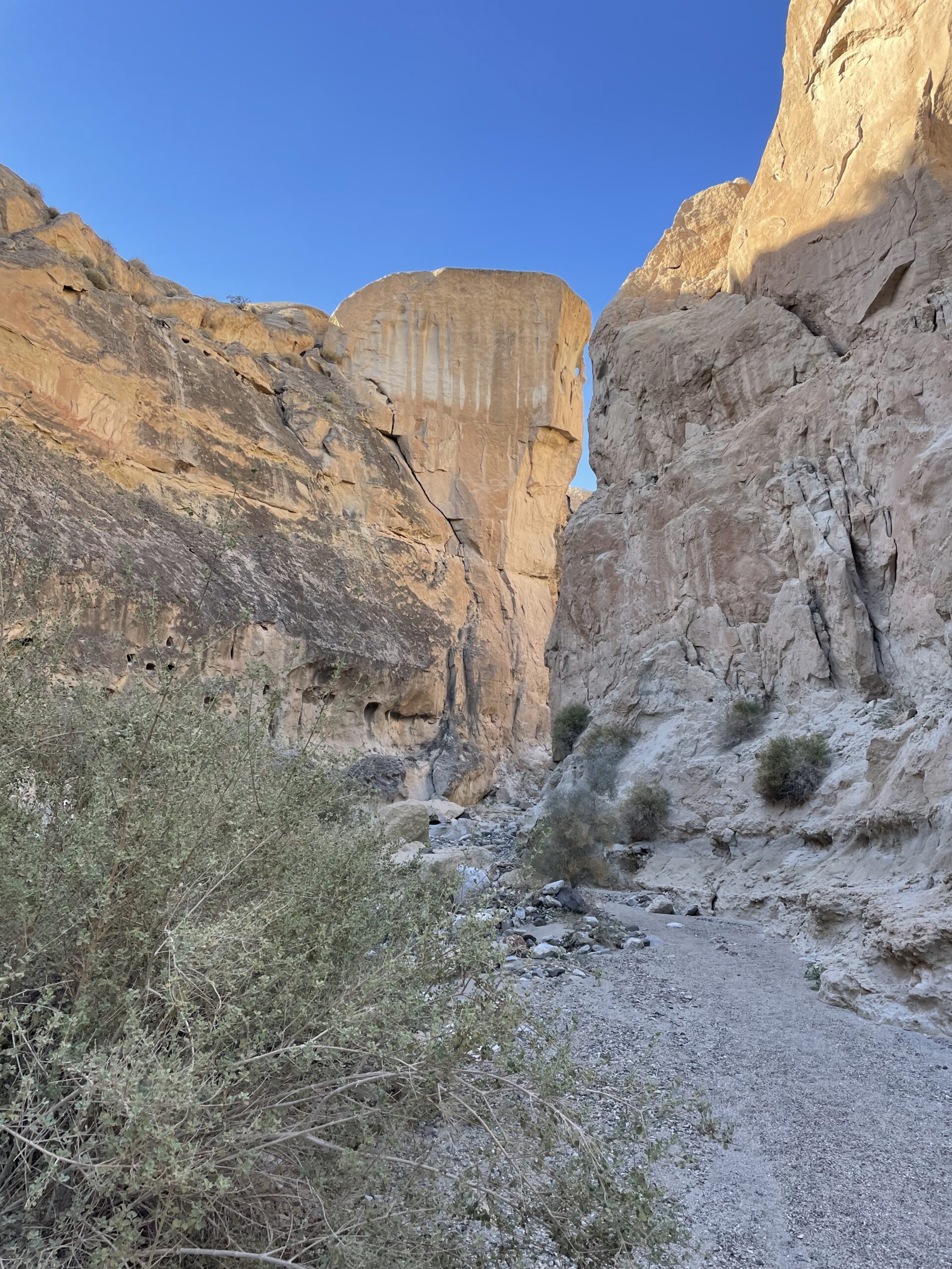
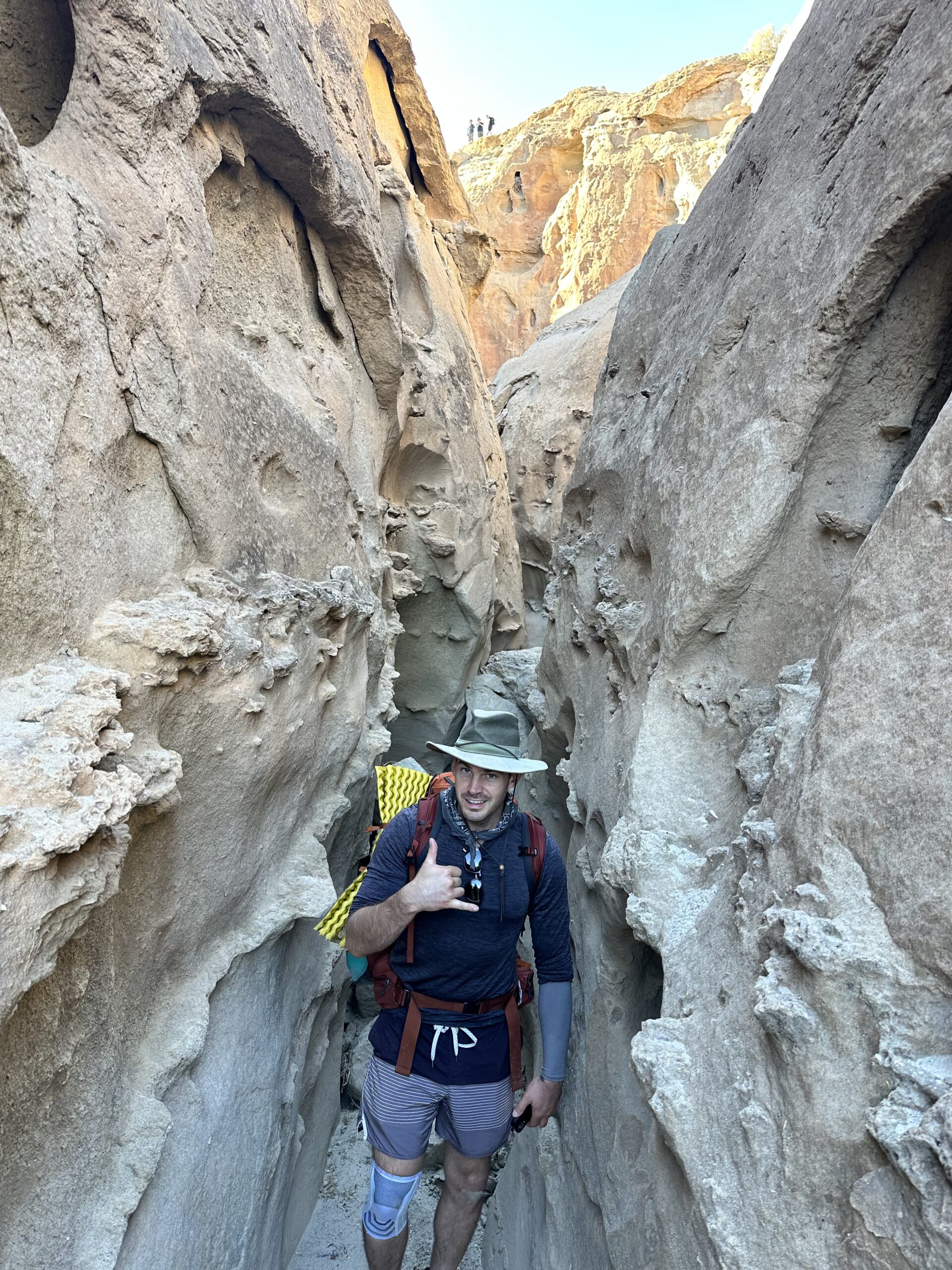
From the parking lots, the trail starts uphill through rockier, exposed terrain. You will then hike through a small wash (dry creek bed) and eventually you’ll turn right up a small rock slab. There are a few small scrambles and squeezes through boulders, but nothing that you can’t do with a backpack.
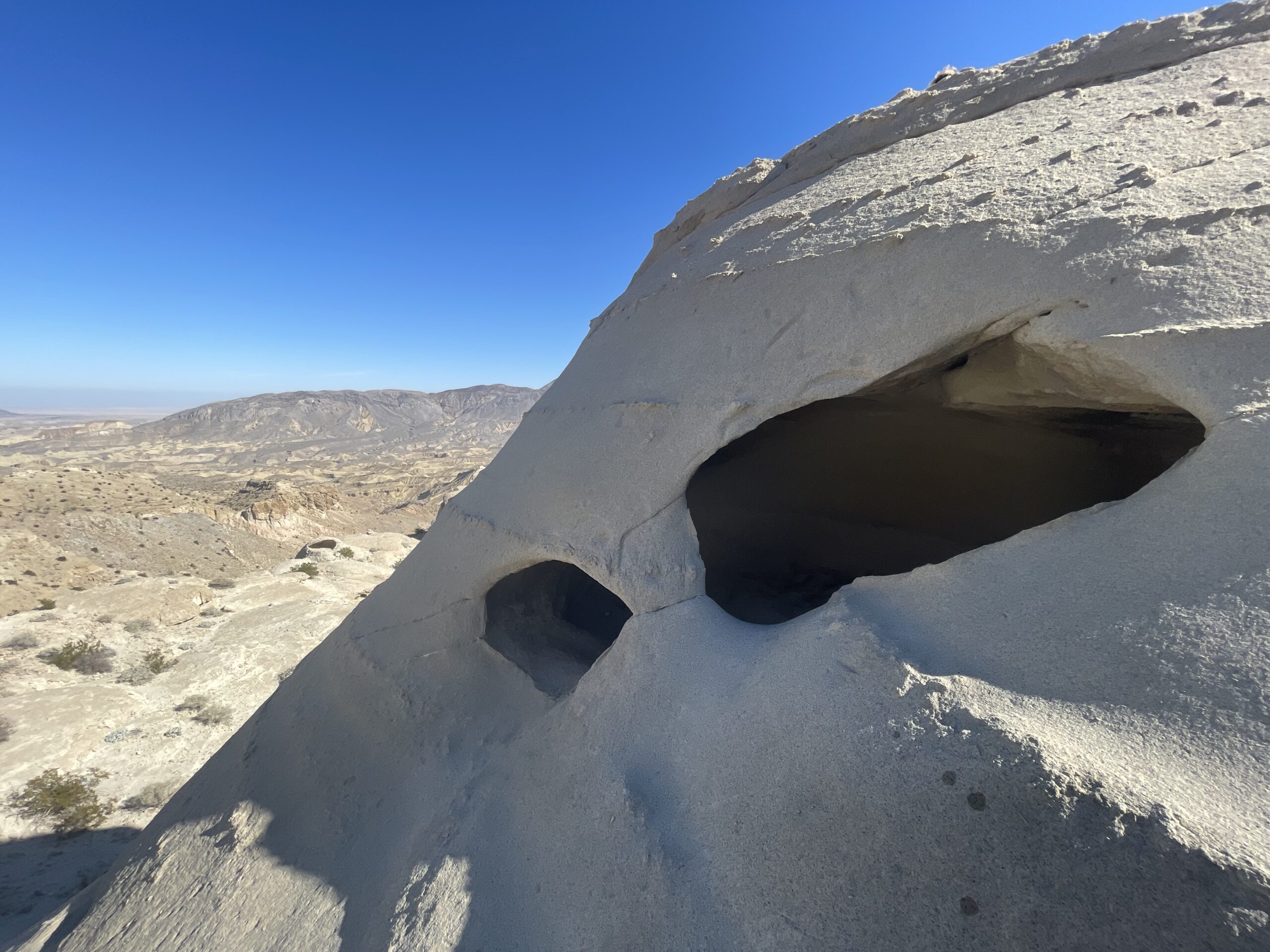
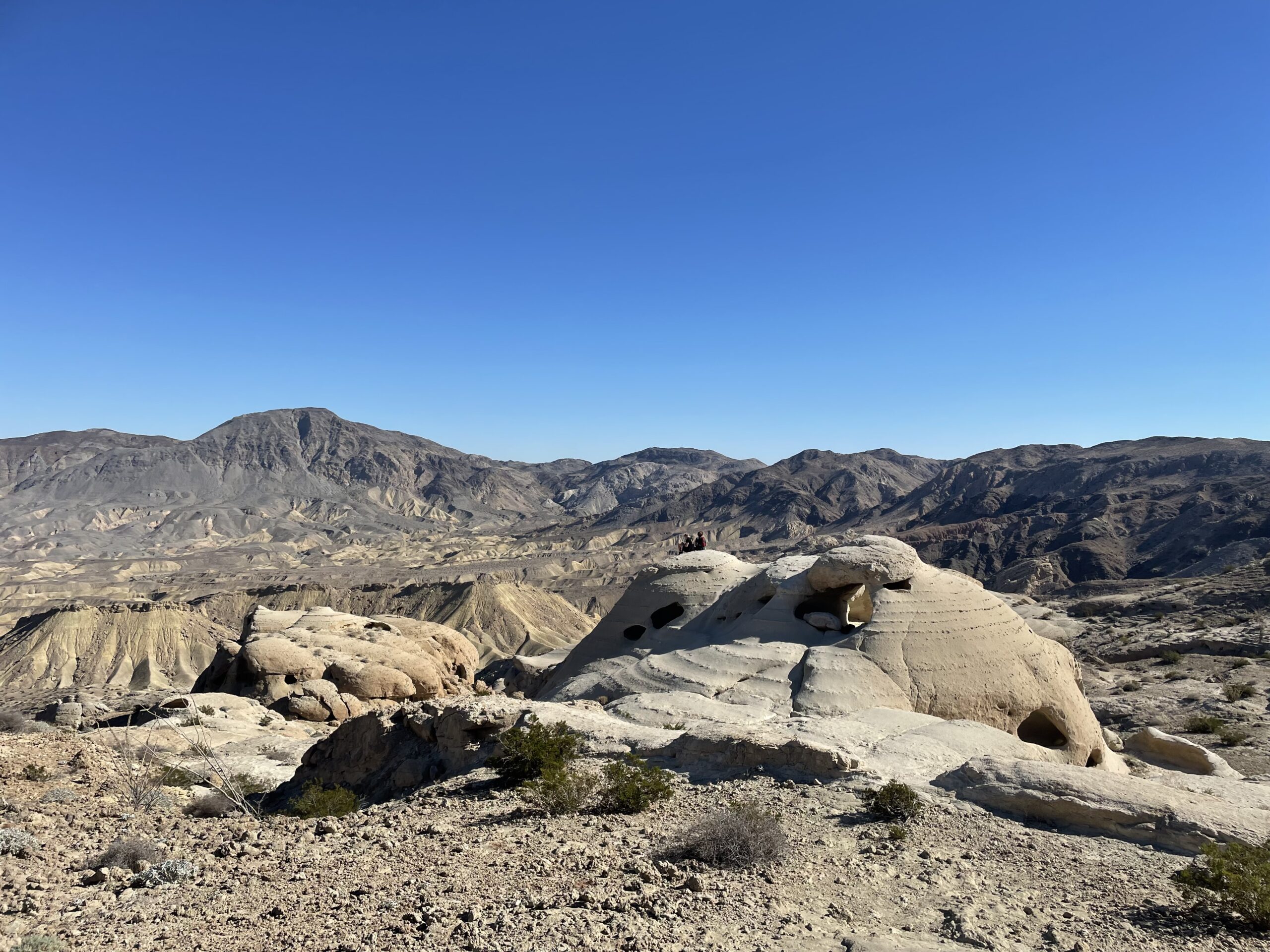
After a steeper incline around 2.5 miles (estimate), you’ll reach a peak. This is where you’ll find the popular wind-caves, which are unique boulder formations that have been pock marked and hollowed from millions of years of rainfall and wind. You can even catch views of the Salton Sea directly east on a clear day.

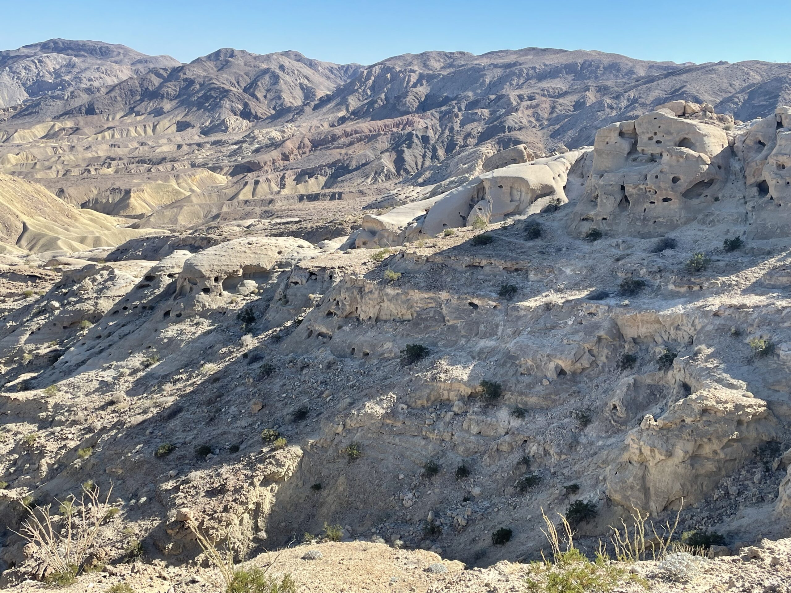
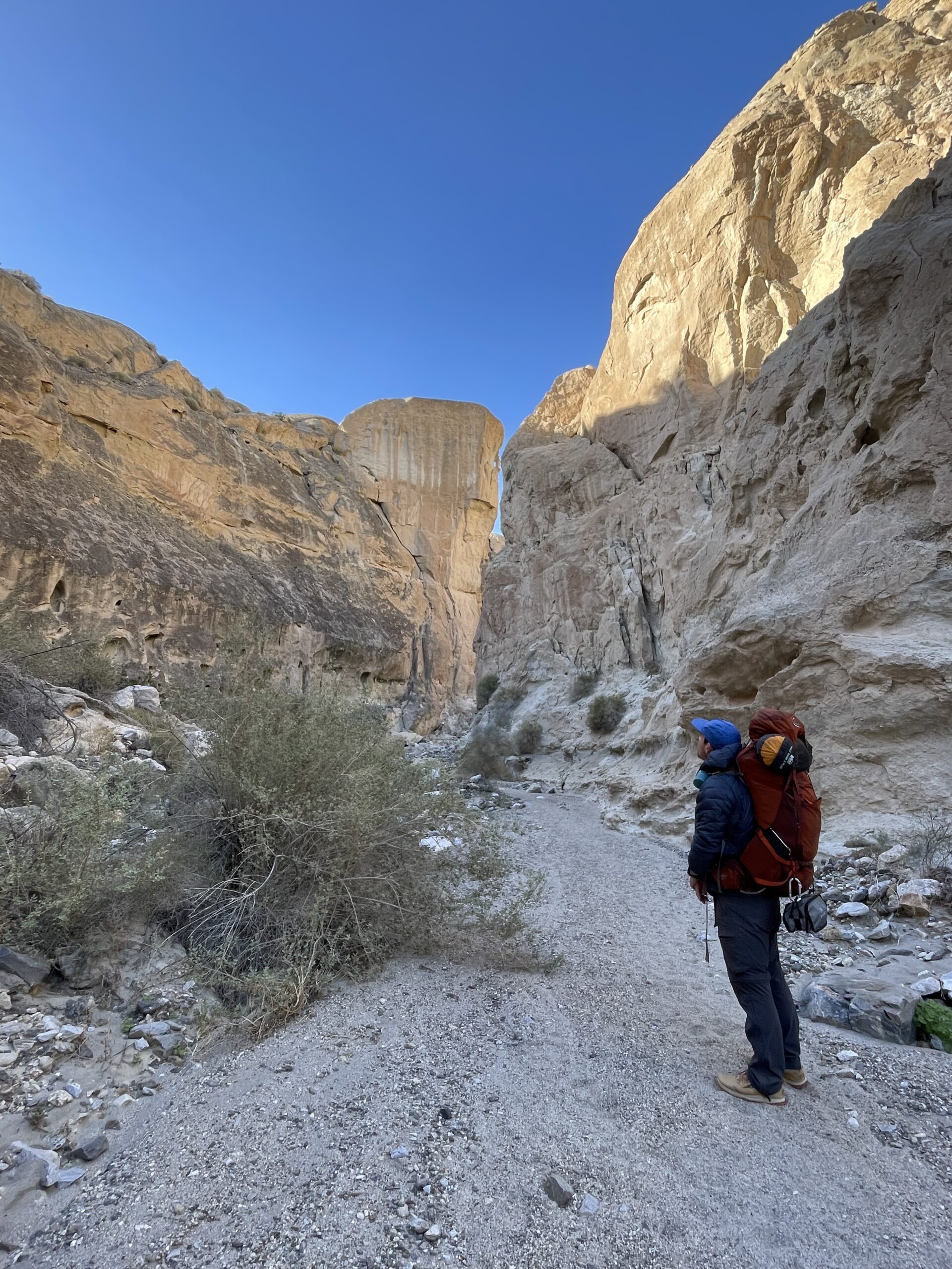
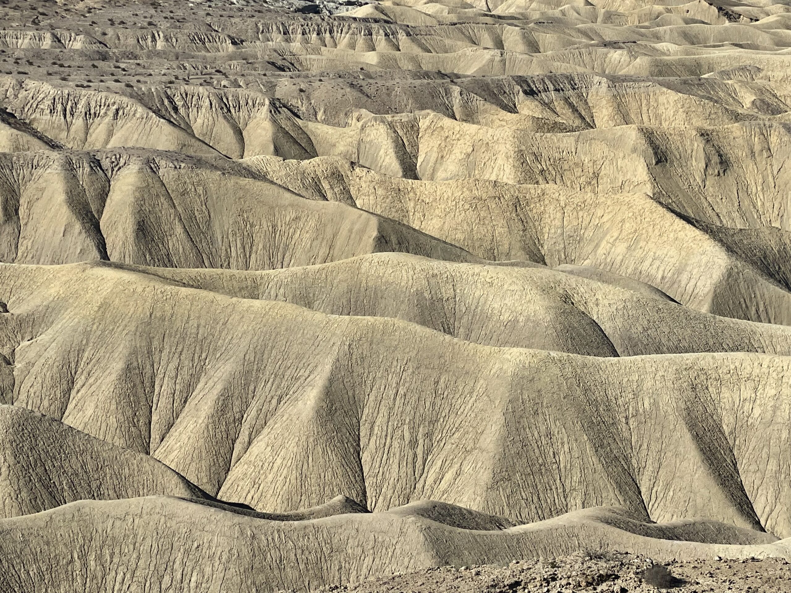
From the wind caves, the trail will start to ascend down. This is really where the fossils begin to appear seemingly everywhere on the ground, and you’ll also have excellent views of the badlands to the north. As you approach the bottom you will see a slot canyon to your right which is another popular area to see, also rich with fossils like sand dollars.
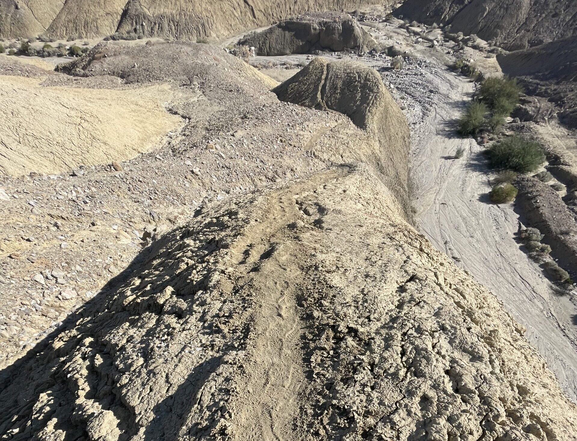
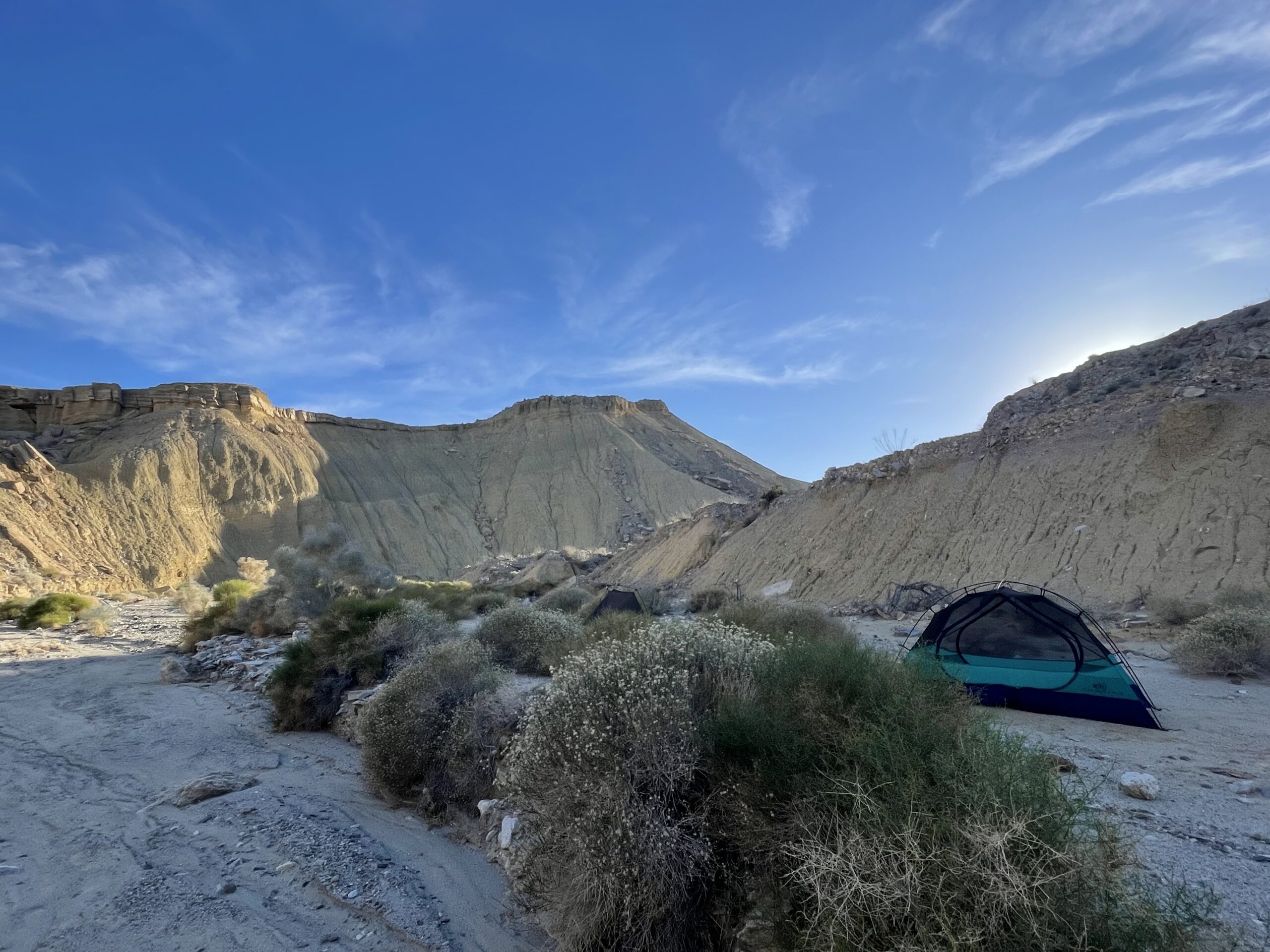
Shortly after the slot canyon at around mile 4.5 (estimate) is the turning point for the loop, where you’ll encounter a larger wash with steep canyon walls. You will need to descend into the wash, but do not follow the canyon edge to the right – this can be dangerous and is not part of the trail. Instead, follow the canyon edge to the left where you’ll see a safer descent, marked by cairns (notes marked on the map).
Where to camp
Once you descend into the wash, you’ll find plenty of wide and flat areas that are great for camping (around mile 4.75).
The area was beautiful, quiet, and surrounded by steep canyon walls. More than accommodating for a good nights’ sleep. Please try to stay off the main wash/trail for the sake of other hikers and backpackers.
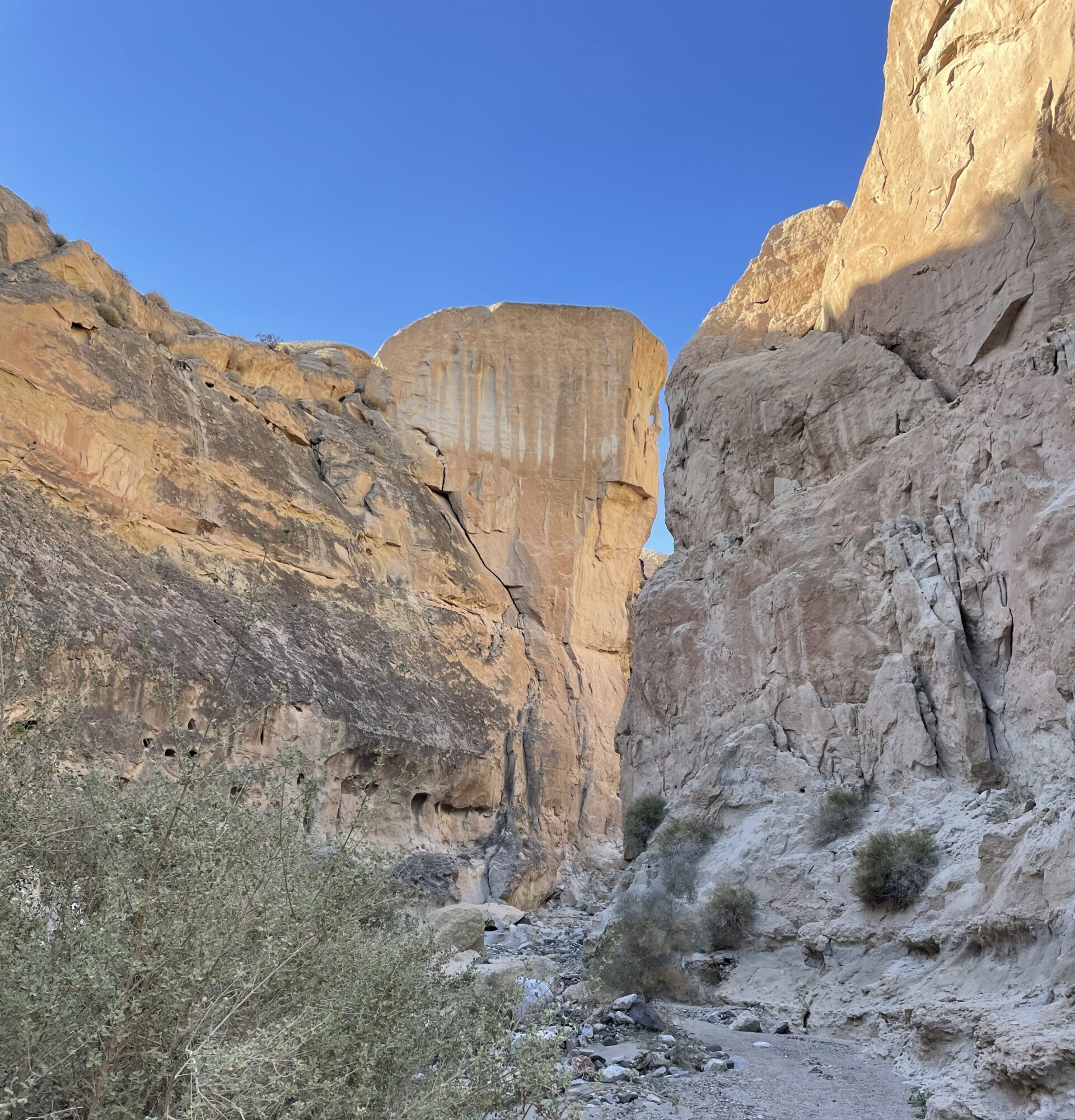
Last section
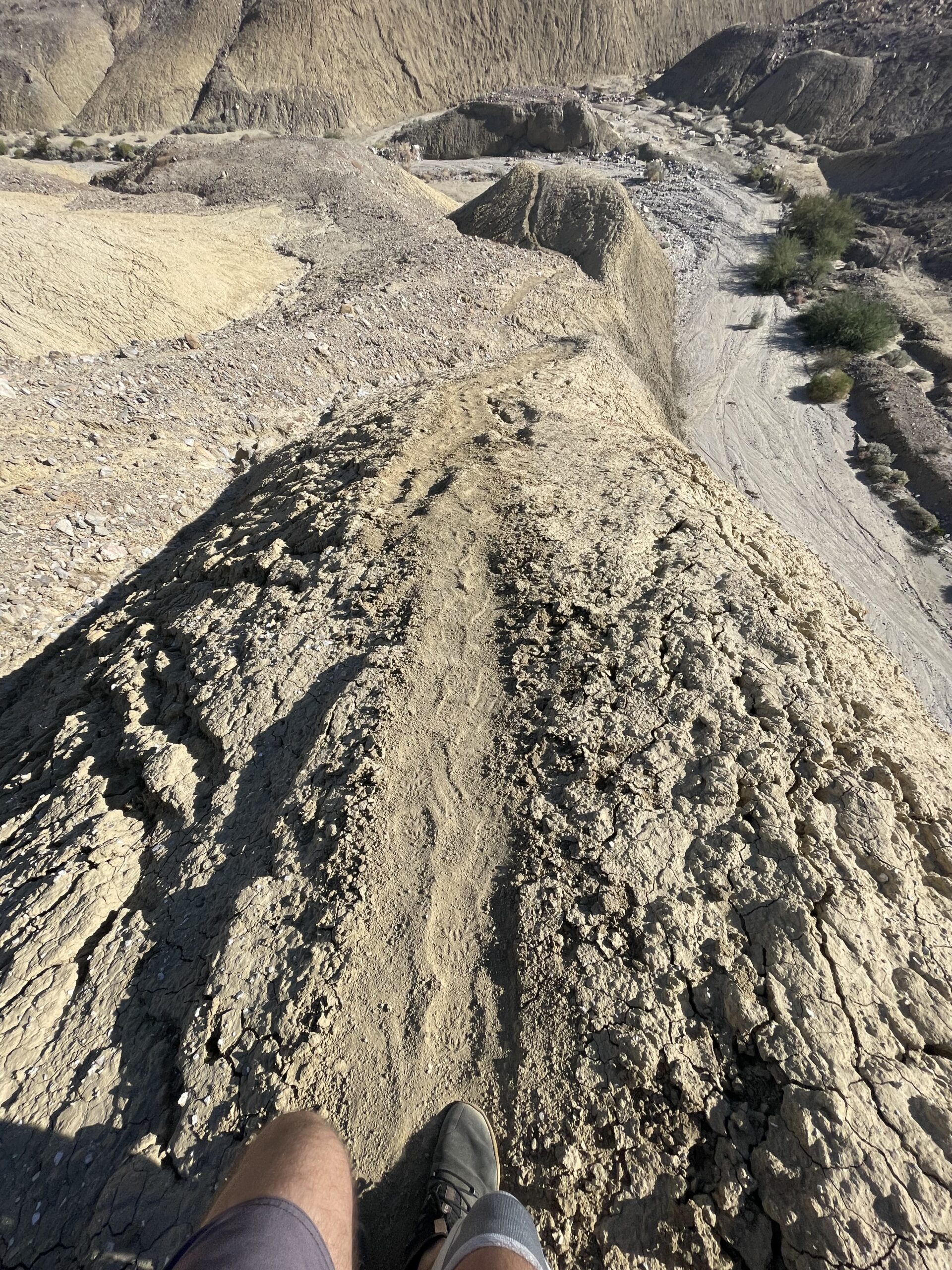
From the camping spot you continue through the canyon. The walls get a bit narrower, but are steep and beautiful with interesting peaks and formations. However, as mentioned above, the second half of the loop is not well defined and requires some actual navigation and keen attention, particularly in the last 2 miles.
Key point (marked on the GPS route): At around mile 6.5 (estimate), you will begin to ascend up and out of the canyon – but finding the trail to ascend here is difficult. The canyon will be divided by a large mound, and it appears that you can go to the right or the left, evident by foot-traffic from previously confused hikers. However, the trail continues up on the actual mound itself, which will bring you out of the canyon. This is a steep and quick climb, and once at the top you can see the windmills in the distance that were visible on your drive in.
The remainder of the hike is not well defined in many areas, and it is recommended you go slow and follow your GPS and maps diligently. At around mile 8 (estimate), you will make a sharp left turn which connects you to the initial wash where you began your hike, and it should start to look familiar. From there it is less than 1 mile (estimate) to the main parking area.
Final Thoughts
This is an excellent trip and I could not recommend it enough for a short but fulfilling adventure. Be very careful and mindful when navigating the second half of the hike, as the trail is not well defined.
Please bring maps, GPS, and plenty of extra water.
To better understand our public lands and how to explore them, check out our articles What are America’s public lands?, How To Explore the Public Lands in America, and Why America’s Public Lands Are Important for Everyone.
Enjoy the journey – J. Wasko
About the author
Jeremy Wasko has been exploring our public lands for over two decades, with thousands of miles and hundreds of camping trips completed. Through his adventures, he discovered that our public lands are more than just places to camp and recreate. They are cultural and historical sites, sacred places to different peoples, and the very sources of our clean water, air, and other critical resources.
He created Magna Terra to share his knowledge on how to explore and enjoy our public lands, and also how to protect and conserve them for future generations.
Learn more about Jeremy and the founding of Magna Terra here.
Photos