CAMPING GUIDE: THE SAN JACINTO MOUNTAINS
For campers seeking a dramatic change from the coastal and shrubby landscape of Socal (albeit beautiful), the San Jacinto Mountains are a must see, filled with huge granite peaks and dense forests. Here you’ll find plenty of developed campgrounds, backcountry sites, and famous trails and vistas.
In this Guide:
Where You Can Camp
Hiking Information
Maps And Navigation
Natural World
History
Camping Etiquette
Support San Jacinto
About The San Jacinto Mountains
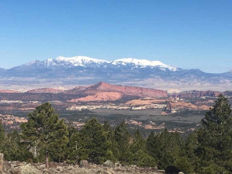
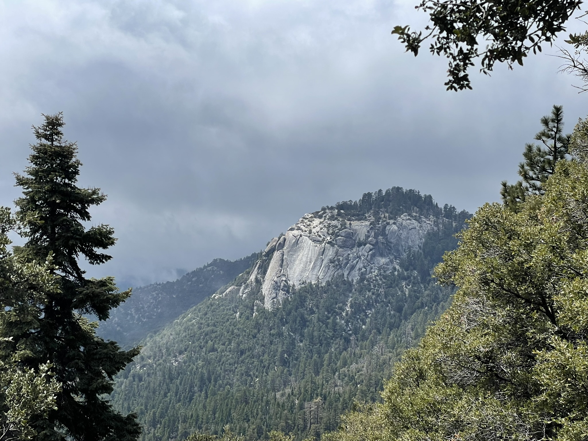
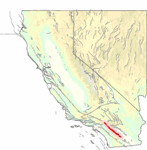
The San Jacinto Mountains are the northernmost part the Peninsular Mountain Range, which extends down to the tip of Baja California, Mexico. They are some of the more dramatic in Southern California with jagged peaks, mature conifer and oak forests, meadows filled wildflowers, and chaparral slopes leading down to a vibrant desert. This wildly diverse area serves as a critical refuge for the wildlife, watersheds, and healthy forests for Southern California. Only two hours from San Diego and Los Angeles, it is a great place to camp for the weekend or extended excursions.
The San Jacinto Mountains are managed by several different public land agencies, each with its own rules and designations for camping. This can seem a bit confusing or intimidating at first, but once you visit and familiarize yourself with the area you’ll find it’s quite easy to navigate.
Below are the different types of public land designations you’ll discover in the San Jacinto mountains, and the agencies that manage them.
Federally Managed Areas
The San Bernardino National Forest
A majority of the San Jacinto Mountains are contained within the San Bernardino National Forest. A National Forest is a unit of land managed by the U.S. Forest Service, which oversees 193 million acres and sits under the Department of Agriculture. The land has a multitude of uses including outdoor recreation, fish and wildlife management, natural resource management such as wildfire mitigation, watersheds, timber, minerals, energy, livestock ranges, and wilderness preservation and ecosystem restoration.
The San Jacinto Wilderness (Managed by the National Forest)
The federal San Jacinto Wilderness was created in 1964, contains 32,248 acres and is managed by the San Bernardino National Forest. A “Wilderness Area” is a specific legal designation for federal public land that focuses on preserving that natural landscape through some stricter regulations to maintain the natural and primitive landscape.
The Santa Rosa National Monument (Managed By The BLM)
Establish in October of 2000, the Santa Rosa and San Jacinto National Monument is co-managed by the BLM (Bureau of Land Management) and the San Bernardino National Forest. Parts of the San Jacinto Wilderness also fall within the National Monument. With a total of 280,000+ acres, you’ll find the diverse landscape of mountains, shrubby landscapes, and high alpine environments that are characteristic of the area.
State Managed Areas
Mount San Jacinto State Park
This park was established in the early 20th century through various land exchanges and acquisitions to help conserve the area amid public pressure and interest. The park has over 14,000 acres of high altitude alpine wilderness, with towering trees and dramatic peaks jutting from the ground.
Mount San Jacinto State Wilderness (Managed By The State Park)
Similar to federal wilderness areas, the State wilderness areas are highly protected natural areas. Covering over 14,000 acres, the Mount San Jacinto State Wilderness was created in 1933 and opened to the public in 1937.
Other Land Management In The San Jacinto Mountains
Many other private, governmental, and tribal agencies help manage and protect the San Jacinto mountains and surrounding areas. This includes the Cahuilla Peoples who own over 19,000 acres of the land, the Philip L. Boyd Deep Canyon Desert Research Center, the Coachella Valley Mountains Conservancy, the Nature Conservancy, the American Land Conservancy, and Friends of the Desert Mountains.
Essential Details When Visiting The San Jacinto Mountains
How To Get There
The San Jacinto Mountains cover a large area, so this depends on your destination. Below are the most common entry points:
Idyllwild-Pine Cove, CA
Idyllwild-Pine Cove, CA is the main jump-off point for visitors of the San Jacinto Mountains. Beyond the opportunities for hiking and camping, you will find plenty of restaurants, shops, art galleries, bookstores, boutique shops, small groceries, and comfortable lodging options. Most interestingly is only non-humans can be voted into the Mayoral position (per the official town charter), which is why a dog has been the Mayor of Idyllwild since 2012. It is currently held by a golden retriever, Mayor Max III. Find out more here.
- From San Diego it is about 2 hours by car – Google maps directions from San Diego to Idyllwild.
- From Los Angeles it is about 2 hours by car – Google maps directions from Los Angeles to Idyllwild.
- From Palm Springs is about 1 hour by car – Google maps directions from Palm Springs to Idyllwild.
Palm Springs Aerial Tramway
An iconic attraction of the area, this cable car takes visitors from Palm Springs directly up to the San Jacinto Mountains, dropping you off at the Visitors Center and Peaks Restaurant. From here you can access trails and camping areas, including San Jacinto peak. Closed during winter seasons, tickets and more information can be found here.
Pines to Palms Highway
This highway runs through the Santa Rosa National Monument, providing epic views and access to hiking trails and camping options. With a few dusty towns in between, this brings you between Palm springs and Idyllwild.
When To Visit
Spring weather can be favorable for hiking and camping in San Jacinto at lower elevations, but you will find plenty of snow and wet conditions along the trails and peaks. With the spring weather, you will encounter beautiful wildflower blooms in the meadows and forests. Campgrounds will still be closed until late spring, but backcountry is allowed year-round with a permit. With the spring run-off you are also more likely to encounter rock slides and mud slides on both the trails and roads, so take extra precaution during this time.
Summer is still open for camping, hiking, and climbing, but please be mindful as the heat can be extreme during certain times of the summer. This is particularly true in the desert areas where it is recommended you avoid visiting until cooler seasons. Do NOT underestimate the risk of extreme heat. Regardless, summer brings heavier traffic and crowds. Thankfully, the wilderness and forests are expansive enough to find at least some level of solitude, should that be what you are seeking.
Fall is one of the best times to visit, with warm but slightly drier conditions that are great for hiking and camping. It can get very chilly at night with a risk of snow the later you get in the fall, so be prepared for temperature swings. Campgrounds begin to close in the fall as well, but overnight backcountry camping is still allowed with a permit year round.
Winter brings out the sports of snowshoeing and cross-country skiing, but access is limited to how far you’re willing to hike. All campgrounds are closed, but backcountry camping is allowed with permits (winter camping takes additional skills and knowledge).
Points Of Interest
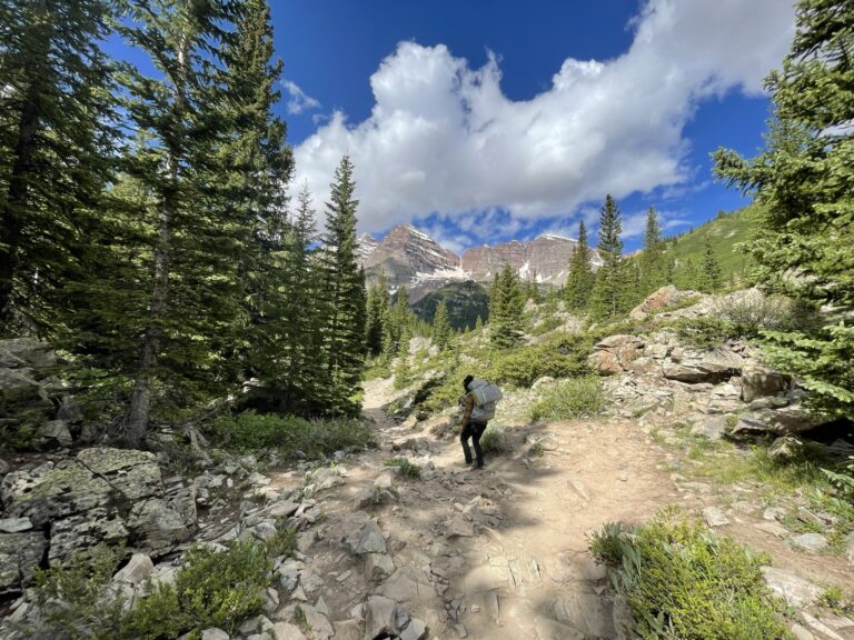
Pacific Crest Trail: The famous PCT goes directly through the San Jacinto mountains. You’ll often find through hikers camping out in the early spring, or stopping in the town of Idyllwild to re-supply with food and gear.
Mount San Jacinto: The second highest peak in Southern California at 10,834 feet, this is a popular but challenging summit for day hikers and backpackers, with expansive views of the surrounding mountain ranges and desert down below.
Cactus To Clouds Hike: Considered the hardest day hike in the entire world (yes, really), this hike starts down in the desert floor of Palm Springs and goes straight up to the peak of Mount San Jacinto. There is no camping on this trail, water sources are few, and you are ascending over 10,500 feet in a single trip. Many have died on this trail. As such, it takes some significant planning for which I recommend this guide from The Hiking Guy.
Palm Springs Arial Tramway: A less extreme way to ascend to the hiking trails is the famous tramway that brings you to the Long Valley Ranger Station, and a restaurant overlooking the desert valley. Check out more information here.
Idyllwild: A fun, artistic town with a dog for a mayor. Get yourself some tasty food and ice cream, re-supply on gear and firewood, and enjoy the wholesome town.
Types Of Camping Allowed In The San Jacinto Mountains
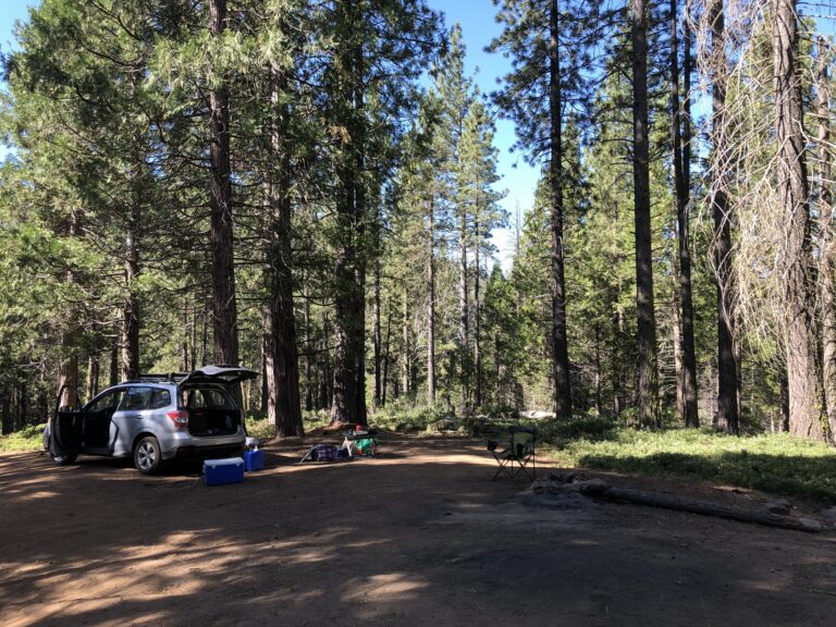
Car camping: Driving up to a camping area and packing your gear in a car. This can be at a developed campground, primitive campground, or on your own as dispersed camping. Ultimately, anywhere you camp with your car is “car camping.” For a full guide on car camping, read our Car Camping Basics article
Backpacking: Where you travel only by foot and carry all your gear, food, and supplies in a backpack. You could backpack to a dispersed camping area, developed campground, or primitive campground. For a full guide on backpacking, read our Backpacking Basics article
Solo camping: Where you do any of the above, but by yourself. Why does this need a distinct category? Because it requires a different level of planning, resourcefulness, and skills that is worth reviewing independently. For a full guide on solo camping, read our Solo Camping Basics article
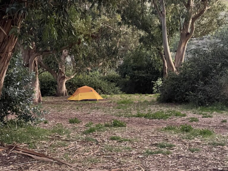
Where You Can Camp In The San Jacinto Mountains
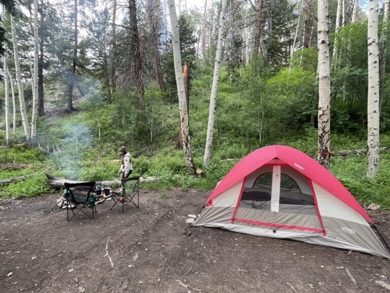
Developed Campgrounds:
A designated camping area with basic amenities and facilities usually including fire rings, vault toilets (no water or flushing), tent platforms, potable water spigots, firewood for sale, and picnic tables. Oftentimes a campground host will be present to answer questions and collect fees.
Marion Mountain Campground
Managed by: San Bernardino National Forest
Number of campsites: 24
Reservations/permits: Reservations can made on www.recreation.gov, or you can call the San Jacinto Ranger District at (909) 382-2921 for details and availability.
Campfires: Only allowed in designated fire rings.
Fern Basin Campground
Managed by: San Bernardino National Forest
Number of campsites: 24
Reservations/permits: Reservations can made on www.recreation.gov, or you can call the San Jacinto Ranger District at (909) 382-2921 for details and availability.
Campfires: Only allowed in designated fire rings.
Dark Canyon Campground
Managed by: San Bernardino National Forest
Number of campsites: NA
Reservations/permits: Reservations can made on www.recreation.gov, or you can call the San Jacinto Ranger District at (909) 382-2921 for details and availability.
Campfires: Only allowed in designated fire rings.
Black Mountain Group Campground
Managed by: San Bernardino National Forest
Number of campsites: 1
Reservations/permits: Reservations can made on www.recreation.gov, or you can call the San Jacinto Ranger District at (909) 382-2921 for details and availability.
Details:
Stone Creek Campground
Managed by: California State Parks
Number of campsites: 50
Reservations/permits: Reservations can be made on www.reservecalifornia.com, or you can contact the Mount San Jacinto State Park Headquarters at (951) 659-2607 for details and availability.
Campfires: Only allowed in designated fire rings.
Idyllwild Campground
Managed by: California State Parks
Number of campsites: 34
Reservations/permits: Reservations can be made on www.reservecalifornia.com, or you can contact the Mount San Jacinto State Park Headquarters at (951) 659-2607 for details and availability.
Campfires: Only allowed in designated fire rings.
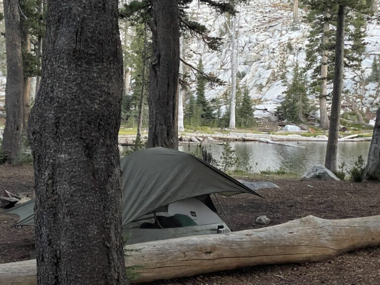
Primitive Campsites:
A “primitive” campsite is designated camping area with little to no amenities, usually just a place to set up your tent. You may get lucky with a fire ring, but these campgrounds are mainly to provide safe areas for people to camp in more remote places and to help protect the landscape and wildlife by preventing excessive dispersed camping.
Strawberry Junction
Managed by: California State Parks
Number of campsites: 3
Reservations/permits: Overnight permits are required and cost $5. Permits are limited since there are few sites available. Permits can be mailed in advance to the ranger station by filling out this application, or can be obtained in person at the Mount San Jacinto State Park Headquarters, the Stone Creek Campground, or the Long Valley Ranger Station.
Campfires: NO campfires allowed. Only gas stoves are permitted. You must obtain a free California Campfire permit for any type of fire use (including gas stoves).
Round Valley
Managed by: California State Parks
Number of campsites: 28
Reservations/permits: Overnight permits are required and cost $5. Permits are limited since there are few sites available. Permits can be mailed in advance to the ranger station by filling out this application, or can be obtained in person at the Mount San Jacinto State Park Headquarters, the Stone Creek Campground, or the Long Valley Ranger Station.
Campfires: NO campfires allowed. Only gas stoves are permitted. You must obtain a free California Campfire permit for any type of fire use (including gas stoves).
Little Round Valley
Managed by: California State Parks
Number of campsites: 6
Reservations/permits: Overnight permits are required and cost $5. Permits are limited since there are few sites available. Permits can be mailed in advance to the ranger station by filling out this application, or can be obtained in person at the Mount San Jacinto State Park Headquarters, the Stone Creek Campground, or the Long Valley Ranger Station.
Campfires: NO campfires allowed. Only gas stoves are permitted. You must obtain a free California Campfire permit for any type of fire use (including gas stoves).
Black Mountain Road Yellow Post Sites
Managed by: San Bernardino National Forest
Number of campsites: 6
Reservations/permits: First come first served. California Fire Permit required (free).
Campfires: NO campfires allowed. Only gas stoves are permitted. You must obtain a free California Campfire permit for any type of fire use (including gas stoves).
South Ridge Road Yellow Post Sites
Managed by: San Bernardino National Forest
Number of campsites: 6
Reservations/permits: First come first served. California Fire Permit required (free).
Campfires: NO campfires allowed. Only gas stoves are permitted. You must obtain a free California Campfire permit for any type of fire use (including gas stoves).
Dispersed Camping:
This type of camping is only allowed in designated zones in the San Bernardino National Forest (Federal), and can only be done via backpacking in this region. For more information, check out this map of the dispersed camping zones.
When dispersed camping, visitors must camp at least 100 feet away from trails, water sources, meadows, and other campers. It is encouraged to use existing camping spots instead of creating a new one, when possible.
Chinquapin zone – San Jacinto Wilderness
Managed by: San Bernardino National Forest
Number of campsites: Depends on zone assignment and/or brown post assignment.
Reservations/permits: Permits are free and can be obtained in advance by filling out and mailing in this application, for details and availability, or permits can be obtained in person at the following ranger district offices: 54270 Pine Crest, Idyllwild, CA 92549. Self-issued permits are available outside of the main doors.
Campfires: NO campfires allowed. Only gas stoves are permitted. You must obtain a free California Campfire permit for any type of fire use (including gas stoves).
Skunk Cabbage zone – San Jacinto Wilderness
Managed by: San Bernardino National Forest
Number of campsites: Depends on zone assignment and/or brown post assignment.
Reservations/permits: Permits are free and can be obtained in advance by filling out and mailing in this application, or can be obtained in person at the following ranger district offices: 54270 Pine Crest, Idyllwild, CA 92549. Self-issued permits are available outside of the main doors.
Campfires: NO campfires allowed. Only gas stoves are permitted. You must obtain a free California Campfire permit for any type of fire use (including gas stoves).
Tahquitz zone – San Jacinto Wilderness
Managed by: San Bernardino National Forest
Number of campsites: Depends on zone assignment and/or brown post assignment.
Reservations/permits: Permits are free and can be obtained in advance by filling out and mailing in this application, for details and availability, or permits can be obtained in person at the following ranger district offices: 54270 Pine Crest, Idyllwild, CA 92549. Self-issued permits are available outside of the main doors.
Campfires: NO campfires allowed. Only gas stoves are permitted. You must obtain a free California Campfire permit for any type of fire use (including gas stoves).
North Rim zone – San Jacinto Wilderness
Managed by: San Bernardino National Forest
Number of campsites: Depends on zone assignment and/or brown post assignment.
Reservations/permits: Permits are free and can be obtained in advance by filling out and mailing in this application, for details and availability, or permits can be obtained in person at the following ranger district offices: 54270 Pine Crest, Idyllwild, CA 92549. Self-issued permits are available outside of the main doors.
Campfires: NO campfires allowed. Only gas stoves are permitted. You must obtain a free California Campfire permit for any type of fire use (including gas stoves).
Lower Basin zone – San Jacinto Wilderness
Managed by: San Bernardino National Forest
Number of campsites: Depends on zone assignment and/or brown post assignment.
Reservations/permits: Permits are free and can be obtained in advance by filling out and mailing in this application, for details and availability, or permits can be obtained in person at the following ranger district offices: 54270 Pine Crest, Idyllwild, CA 92549. Self-issued permits are available outside of the main doors.
Campfires: NO campfires allowed. Only gas stoves are permitted. You must obtain a free California Campfire permit for any type of fire use (including gas stoves).
Desert View zone – San Jacinto Wilderness
Managed by: San Bernardino National Forest
Number of campsites: Depends on zone assignment and/or brown post assignment.
Reservations/permits: Permits are free and can be obtained in advance by filling out and mailing in this application, for details and availability, or permits can be obtained in person at the following ranger district offices: 54270 Pine Crest, Idyllwild, CA 92549. Self-issued permits are available outside of the main doors.
Campfires: NO campfires allowed. Only gas stoves are permitted. You must obtain a free California Campfire permit for any type of fire use (including gas stoves).
Hiking Information
The San Bernardino National Forest
Free hiking. No permits required.
The San Jacinto Wilderness (Managed by the National Forest)
Day Use Hiking Permits: A day use permit is required to enter the federal wilderness area. Any day use permit from the federal agency is honored by the State agency, and vice versa. Permits are free and are available to grab 24 hours. You must fill out the permit, submit it in the designated drop box, and carry the carbon copy with you. They can be picked up at these locations:
- Mount San Jacinto State Park Headquarters – 25905 Hwy 243, PO Box 308, Idyllwild, CA 92549-0308. Self-issued permits (excluding the Devil’s Slide) are available outside of the main doors.
- Stone Creek Campground located on Dark Canyon Road. Self-issued permits (excluding the Devil’s Slide) are available on the information board upon entering the campground.
- Long Valley Ranger Station – This station is located at the top of the Palm Springs Aerial Tramway. Self-issued permits (excluding the Devil’s Slide) are available outside of the main doors.
The Santa Rosa And San Jacinto National Monument (Managed By The BLM)
Hiking is free, no permits required. Given it’s expanse the BLM organizes this monument into three areas which have excellent hiking options:
- Southern Santa Rosa Mountains Trails and Trailheads
- Northern Santa Rosa Mountains Trails and Trailheads
- San Jacinto Mountains Trails and Trailheads
Mount San Jacinto State Wilderness (California State Parks)
Day Use Hiking Permits: A day use permit is required to enter the State Wilderness Area. Permits are free and are available 24 hours at specific locations. You must fill out the permit, submit it in the designated drop box, and carry the carbon copy with you. Any day use permit from the federal agency is honored by the State agency, and vice versa. Day use permits can be obtained in person at the following locations:
- Mount San Jacinto State Park Headquarters – 25905 Hwy 243, PO Box 308, Idyllwild, CA 92549-0308. Self-issued permits (excluding the Devil’s Slide) are available outside of the main doors.
- Stone Creek Campground located on Dark Canyon Road. Self-issued permits (excluding the Devil’s Slide) are available on the information board upon entering the campground.
- Long Valley Ranger Station – This station is located at the top of the Palm Springs Aerial Tramway. Self-issued permits (excluding the Devil’s Slide) are available outside of the main doors.
Maps And Navigation For The San Jacinto Mountains
Physical maps: It is encouraged to always carry a physical/topographical map of the area, no matter where you’re camping or how familiar you are. Digital resources cannot be relied upon when they power is out, and a physical map can make all the difference in the world. More important is making sure you can understand and read a map of the area, and bring a compass. Here are some suggested physical maps for the San Jacinto Mountains:
Digital maps: When available, these can be a great and accurate tool. However, it highly depends on the map or app you’re using, the ensuring you have enough power, reception, and/or pre-downloaded routes and maps for reliable access. Regardless of the quality and robustness of your digital guides, never forget to bring a physical copy. Here are some suggested digital maps for the San Jacinto Mountains:
Recommendations: I strongly discourage users from relying on AllTrails and other crowd sourced hiking and camping apps. While it is great to see apps encouraging outdoor exploration, crowd sourced information continually leads to misinformation, recorded trails in closed areas, or trail descriptions in which no trail actually exists, creating highly dangerous situations for hikers and campers and significantly damaging the wilderness.
Instead, I recommend only relying on maps and information directly from the managing agency of the area, or using apps and tools that also utilize managing agency information to ensure it is as accurate and safe as possible.
The Natural World Of The San Jacinto Mountains
Fauna
A largely diverse animal population resides in these small but mighty mountains, some of which are critically endangered including the endemic mountain yellow-legged frog.
Keep your distance from wildlife at all times, and never feed or disturb them under any circumstance.

Ring Tail
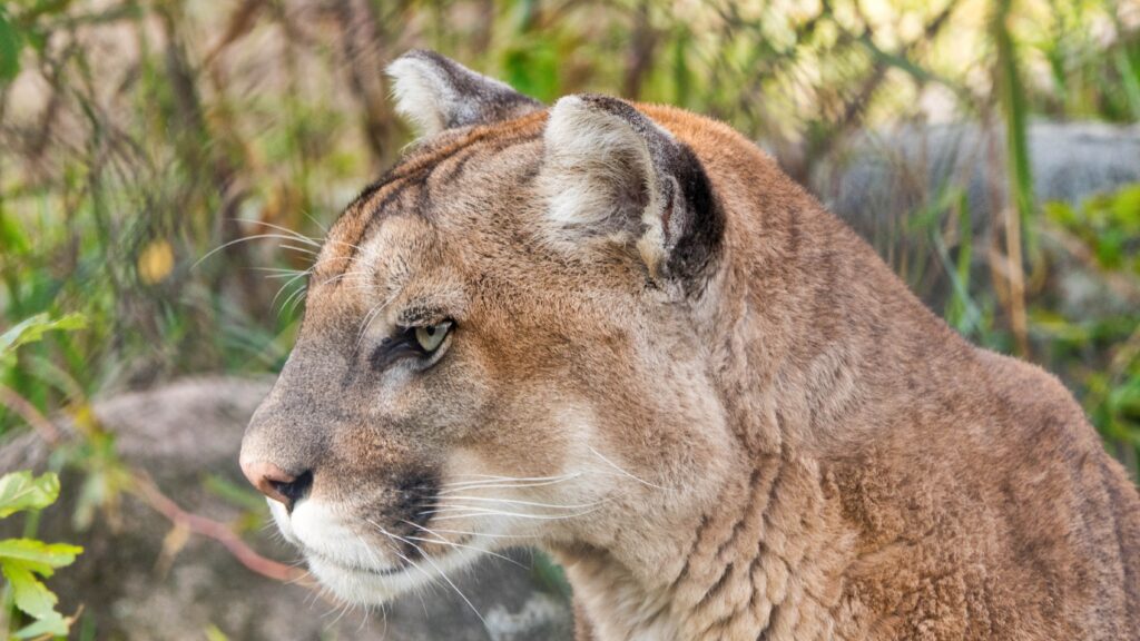
Mountain Lion
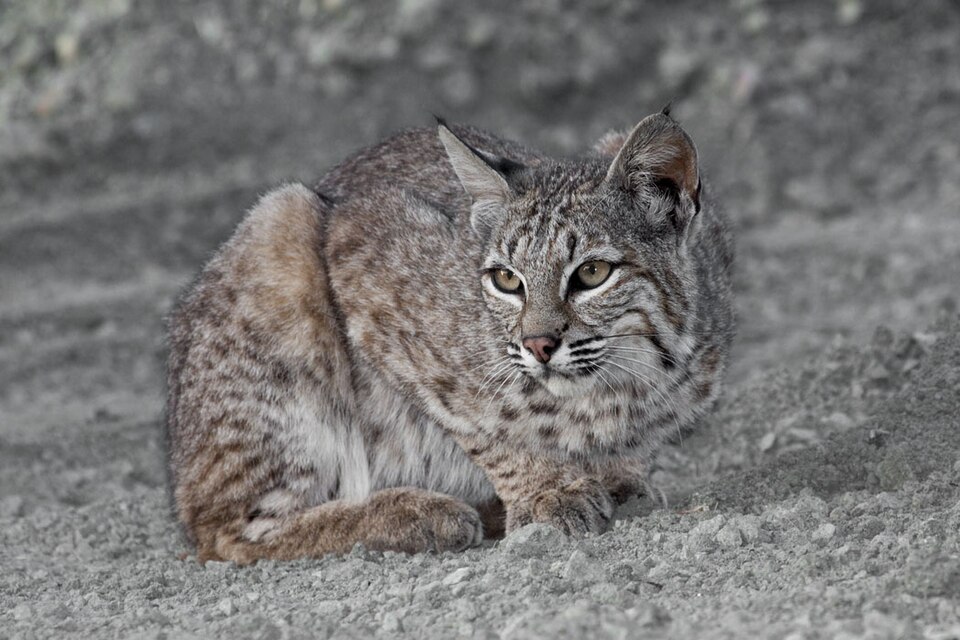
Bobcat
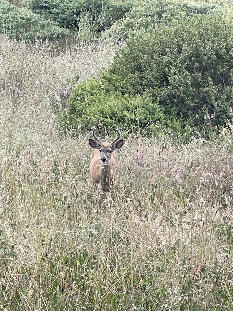
Mule Deer
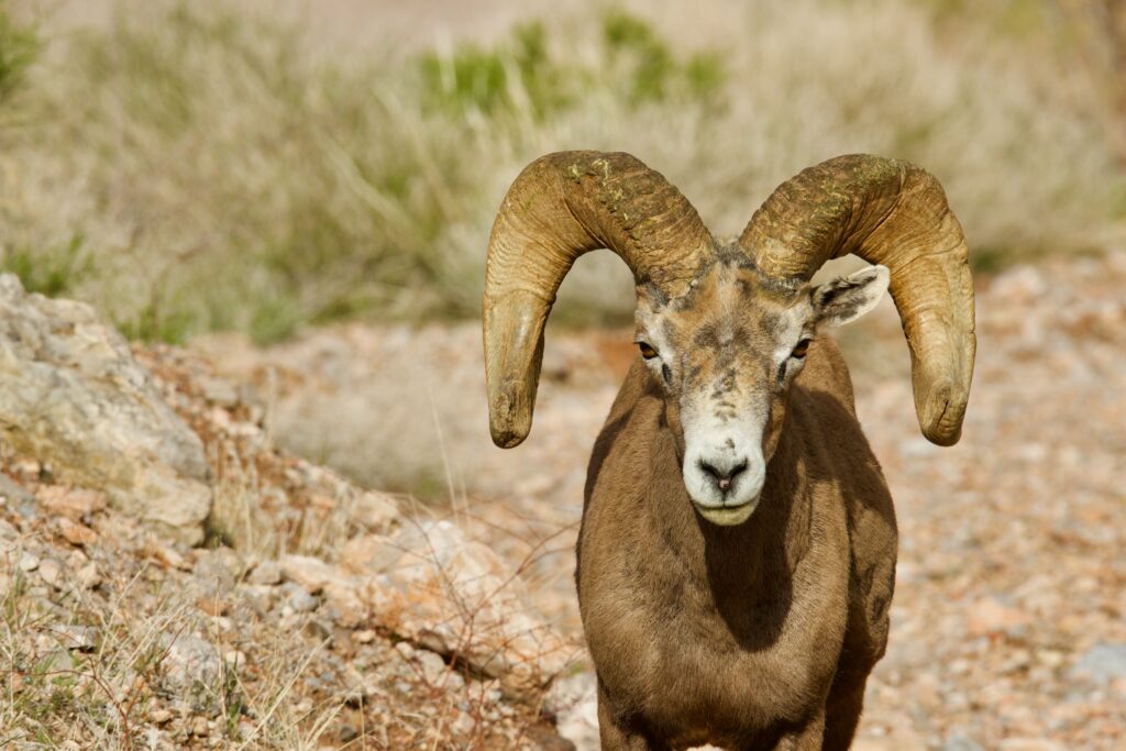
Big Horn Sheep

Mountain Yellow-Legged Frog
Flora
The San Jacinto Mountains provide a dramatic change in scenery and ecosystems from the coastal areas of southern California, including mature pine and cedar forests, several species of oak trees, and ferns and manzanitas creating dense brush and foliage.
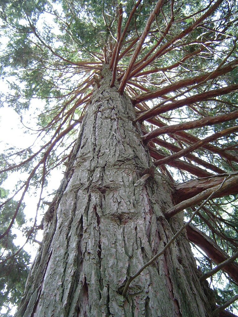
Incense Cedar
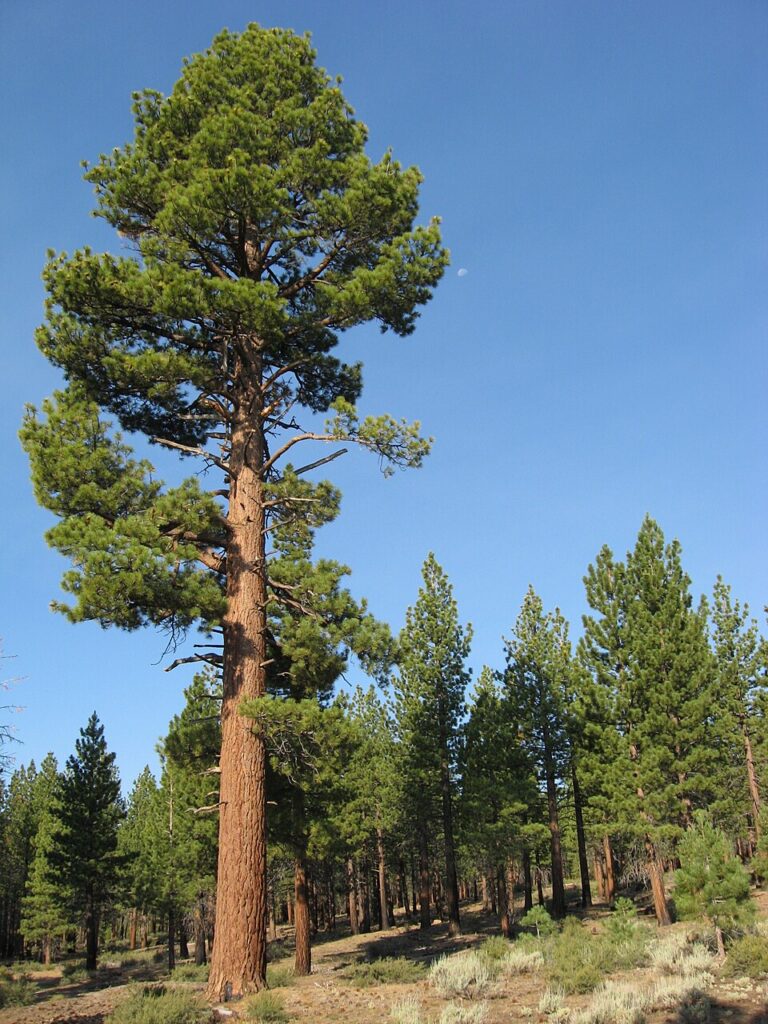
Jeffrey Pine
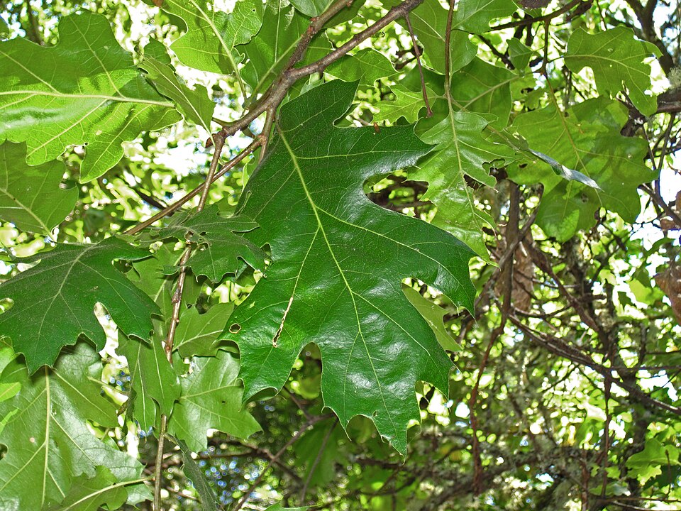
California Black Oak
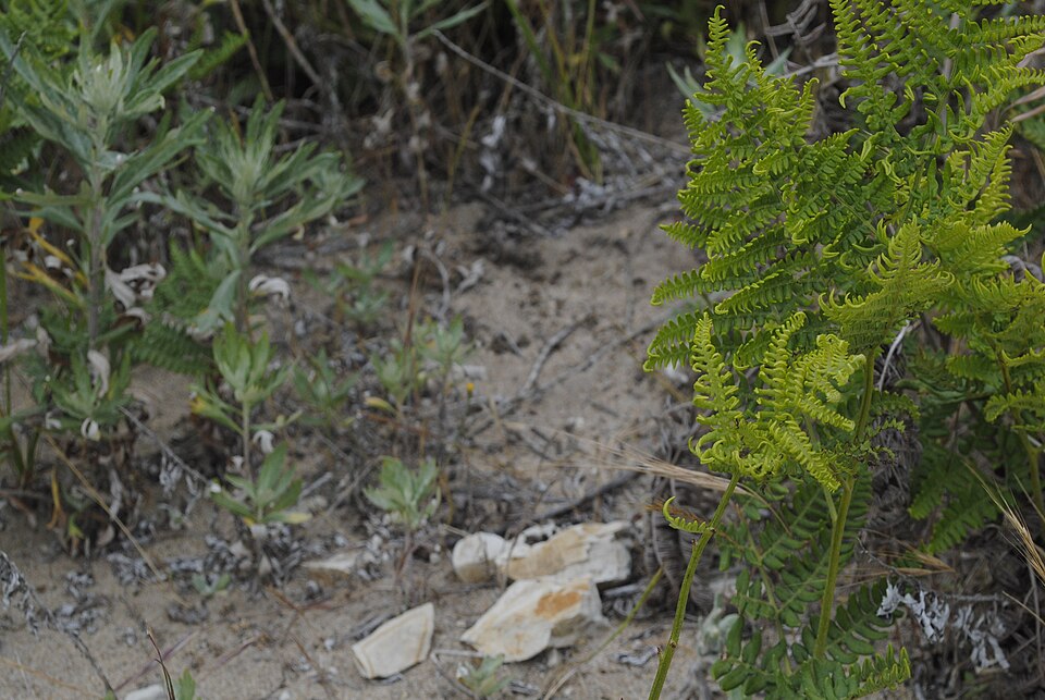
Western Bracken Fern
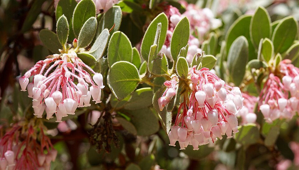
Manzanita
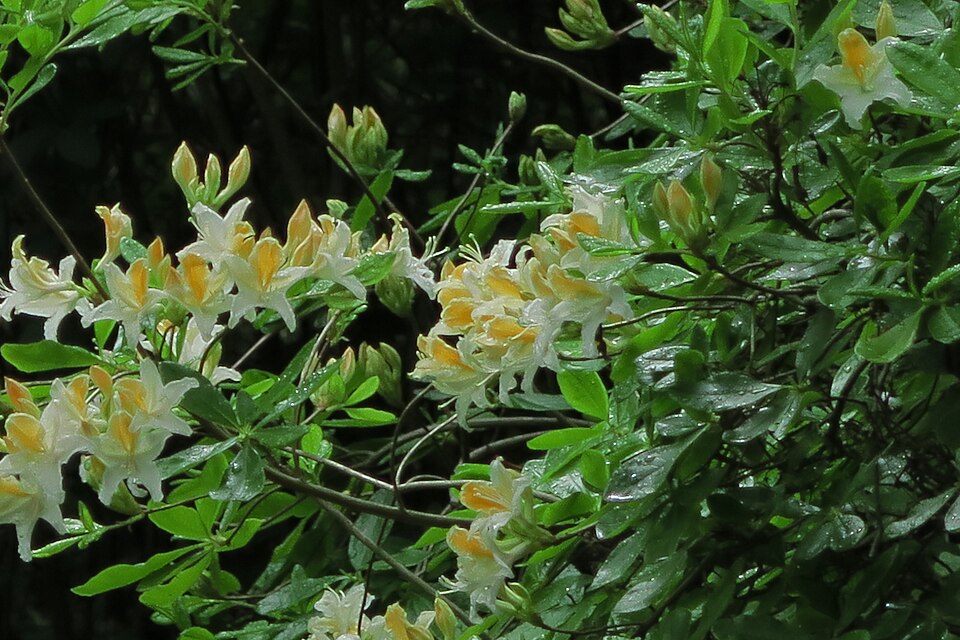
Western Azalea
Geology
During the Cretaceous period (~100 million years ago), the Farallon Plate in the Pacific ocean was being sub-ducted under the North American plate, generating a ton of volcanic activity and magma which created the granite rocks we see today in the Sierra Nevada and Peninsular ranges in California. Through other geologic processes the San Andreas Fault Zone and the San Jacinto Fault Zones were created, bringing intense tectonic activity and earthquakes. As a result, the granite in the Coachella valley area was squeezed and pushed between these fault zones which created the steep peaks of the San Jacinto mountains we see today, known as some of most dramatic elevation changes in North America and around the globe.
History Of San Jacinto
Original inhabitants
The Cahuilla Indians occupied the San Jacinto Mountains and surrounding areas for several thousand years prior to European arrival, and have a deep history with the land. The high mountains and forests were used as seasonal camps, collecting food and supplies like acorns and hunting small game like deer and rabbits. Learn more about them and the existing members of the Cahuilla Band of Indians.
Modern history
In 1852 the Treaty of Temecula was proposed which would have secured ownership of the mountains to the Cahuilla, but unfortunately it failed to pass the Senate, and the Cahuilla were forced into designated reservations. By the late 19th century, prospectors, loggers, and ranchers began developing the area, with the town of Idyllwild supporting more tourism and recreation for the public. Soon, the establishment of the Forest Reserve and eventually the U.S. Forest service, paired with increased interest and pressure from the public on conservation efforts, the State Parks and National Forest areas were established in the mountains, evolving over time into the system we see today.
Etiquette For Wilderness Areas And Public Lands
Leave the place better than you found it.
Human Waste: With the increase in outdoor recreation, human waste is a major challenge on public lands. It is rancid, unsightly, and severely damages the water quality and ecosystem. We strongly support the use of a “Wag Bag.” These are the best option available when it comes to human waste, and we encourage you to help make them more commonplace. The alternative is to dig a cat hole 6-8 inches deep, cover your waste thoroughly, and carry out your toilet paper. But with so many humans, poop and toilet paper plaguing our natural areas, we highly encourage you to use a wag bag.
Water Use: Do not wash your dishes or clothes in water sources, even with biodegradable soap. This is harmful to all species in the water. Do not pee or defecate into water sources. Filter your water and/or bring water back to your camping area as needed.
Music: If you must listen to music, please be mindful and wear headphones on all public lands. Music can travel far and disturb wildlife for miles around, scaring them off their typical paths or territories. Your music also inherently becomes part of everyone else’s experience, including people who may have traveled hours to explore a natural area for some semblance of peace and quiet. Public lands are public, just like being on a bus or sidewalk. Of course there are scenarios in which playing music and making noise is encouraged, like when in grizzly bear country or hiking alone where big game exists.
Staying On Trail: Cutting trails or switchbacks to make shortcuts is highly damaging to wilderness areas. Switchbacks are designed specifically to avoid the risk of rain gullies forming on the hillside. Water follows the path of least resistance, so by cutting a switchback you create a gully in which the water travels down. This has a positive feedback loop of washing away vegetation, creating a wider gully which brings more rain, and washes more vegetation. This washes out trails, destroys vegetation, creates erosion and higher risks for flooding and rockslides, and costs lots of time and money to repair.
Trash: It should always be assumed that there is no trash service on public lands, ever. If you pack it in, then you must pack it out. Bring your own trash bags, and carry out everything. Throwing food scraps and fruit peels in nature is not composting (which is a chemical process involving heat and pressure), it is littering.
Camping Areas: Camp at least 200 feet away from all rivers, lakes, and water sources, as well as trails and other campsites. This is to protect the environment, and shows consideration for everyone else visiting the wilderness areas who are wishing to find the same quiet, majestic natural areas that you came to see. Because it is virtually impossible to be invisible, please try to stay out of sight and out of sound of other campers when practical and possible.
Leave No Trace: There are 7 core principles for Leave No Trace. They should be followed on any public land or natural setting.
How To Support The San Jacinto Mountains
- Friends of San Jacinto Mountain County Parks
- San Jacinto Trail Report
- Idyllwild Forest Health Project
A Note on Public Lands Today
Public lands in the United States exist because people chose long-term care over short-term gain. Lands that had been previously stewarded for generations by Indigenous nations. That protection is never guaranteed. It depends on laws, funding, leadership, and public attention.
Unfortunately, recent federal decisions have weakened protections and increased pressure from extractive use and private enterprises. This puts ecosystems, natural resources, wildlife, cultural sites, historical sites, the economy, and public access at major risk.
If you appreciate public lands and the benefits they provide to all of us, please help support them.